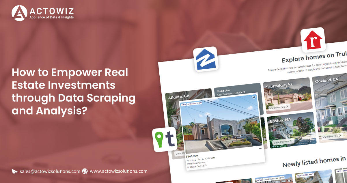
Introduction
Investing in real estate often requires in-depth analysis of property information, and sometimes, traditional sources may not provide all the necessary data. In this blog post, we will explore how to scrape and analyze real estate data based on Parcel Index Numbers (PINs) from various counties in the state of Illinois. We'll cover the collection of essential property information and demonstrate how this data can be used for investment decisions across different scenarios.
Overview
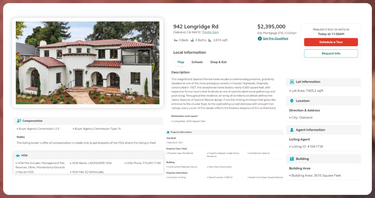
Our goal is to collect the following property information from public GIS websites while ensuring compliance with potential query restrictions for IP addresses:
- Adjacent property owners
- Aerial photography
- Assessed value
- County
- Dimensions
- Legal description
- Legal type
- Location (latitude and longitude of geographic corners)
- Property taxes
- Sales price history
- Shape
- Township
Determining Land Parcel Suitability for Cellular Towers

When considering the suitability of a land parcel for cellular tower installation, it's crucial to assess various factors. By combining the scraped real estate data with additional information, such as radio signal strength data, cellular coverage maps, and local ordinances, you can make informed decisions.
1. Radio Signal Strength Data: Analyzing radio signal strength in the area can help you identify gaps in cellular coverage. This data can be overlaid onto the geographic information obtained from the scraped data. By visualizing signal strength on a map, you can pinpoint areas where additional cellular towers may be needed.
2. Cellular Coverage: Understanding the existing cellular coverage in the region is essential. By integrating cellular coverage maps with your scraped data, you can identify underserved or poorly covered areas that might benefit from new towers.
3. Local Ordinances: Different municipalities may have specific zoning regulations and ordinances governing the installation of cellular towers. By cross-referencing the legal information from the scraped data with local ordinances, you can determine whether a particular parcel complies with regulations. This ensures that you invest in land parcels where tower installation is legally feasible.
Evaluating Land Parcel Suitability for Sale to Adjacent Parcel Owners
Sometimes, selling a land parcel to adjacent property owners can be a strategic move. To evaluate the suitability of a parcel for this purpose, you can use the scraped real estate data:
1. Data from Adjacent Land Parcels: By analyzing the data from adjacent land parcels, you can assess the needs and interests of neighboring property owners. This information can help you identify parcels that may be of particular interest to adjacent owners for expansion or consolidation of their holdings.
2. Legal Information: The legal type, legal description, and property dimensions from the scraped data are valuable when negotiating with adjacent owners. These details can facilitate discussions regarding property boundaries and potential land use changes.
Assessing Suitability for Farm Equipment Storage
For evaluating the suitability of a land parcel for farm equipment storage, the following steps can be taken:
1. Local Road Information: Combining the scraped data with local road information is essential. Easy access to the property and its proximity to suitable roads for transporting farm equipment are crucial factors to consider.
2. Property Dimensions: Knowing the dimensions of the land parcel helps determine whether it can accommodate the storage needs of farm equipment, including vehicles, trailers, RVs, and mobile homes.
Determining Suitability for Billboards or Signage
To determine whether a land parcel is suitable for billboards or signage, consider the following:
1. Local Traffic Data: Combining local traffic data with the scraped real estate data helps identify high-traffic areas. This information is essential for assessing the visibility and potential advertising value of the parcel.
2. Property Dimensions and Shape: The dimensions and shape of the land parcel play a role in determining where and how signage can be placed. A larger, rectangular parcel may be more suitable for billboard placement.
Evaluating Suitability for Wind Turbine or Solar Panel Installation
For assessing the suitability of a land parcel for renewable energy installations, take the following steps:
1. Sun Exposure and Wind Strength: Combine the scraped data with sun exposure and wind strength data to identify parcels with optimal renewable energy potential. Locations with consistent sunlight and strong wind are ideal for solar panels and wind turbines.
2. Existing Wind Turbines: Determine if there are existing wind turbines in the area by using the scraped data. This information can indicate the viability and acceptance of renewable energy projects in the region.
Evaluating Alternative Uses for Similar Parcels
Finally, the collected data can be used to evaluate alternative uses for similar parcels. By comparing and contrasting various properties based on their dimensions, legal types, assessed values, and other attributes, you can explore different investment opportunities. This analytical approach can lead to creative and profitable real estate investment strategies beyond the scenarios mentioned above.
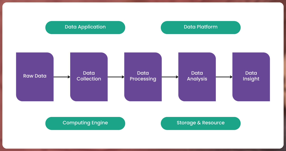
Main Program
The main program serves as the core of your real estate data scraping and analysis project. It coordinates the various tasks, modules, and data sources. Here's a breakdown of its key components:
Importing PIN Data
Importing PIN data is the first step in your real estate data analysis journey. It involves gathering data about specific properties using their Parcel Index Numbers (PINs) from a variety of file formats. Let's explore this component:
Supported File Formats:
Your program should be able to read and extract PIN data from various file formats, including:
txt (Text Files): These plain text files may contain PINs, each on a separate line.
rtf (Rich Text Format): Extract PINs from RTF files, which can include text formatting.
csv (Comma-Separated Values): Common for data storage, CSV files contain PINs as structured data.
tsv (Tab-Separated Values): Similar to CSV but uses tabs as separators.
xls and xlsx (Microsoft Excel): Excel spreadsheets may contain PIN data in various columns.
Implementation
You can utilize Python libraries like pandas to read these file formats. For instance, the read_csv function in pandas can read data from CSV files, while libraries like openpyxl can handle Excel files.
Adding Counties
In your project, you should provide users with the ability to add counties using GIS web addresses. Counties are the geographical regions where you intend to gather real estate data. Here's how this feature can be implemented:
GIS Web Addresses
Allow users to input GIS web addresses or URLs for specific counties. These addresses should point to the respective county's GIS database or portal.
Integration with Web Scraping
Leverage web scraping techniques to extract data from the provided GIS web addresses. The data may include property details, legal information, assessments, and more.
User Interface
Consider creating a user-friendly interface where users can input GIS web addresses for the counties they want to analyze. You can use Python frameworks like Flask or Django for web-based interfaces.
Data Retrieval
The data retrieval component is responsible for obtaining real estate data from county GIS websites and external sources like Regrid.com. Here's a detailed breakdown:
Obtaining Data from County GIS Websites
- Utilize web scraping libraries like BeautifulSoup and requests to access county GIS websites.
- Identify and collect data fields of interest, such as property location, legal descriptions, assessed values, and property taxes.
- Implement error handling for potential query restrictions or limitations on the number of requests from a single IP address. Use proxies if necessary to avoid query limits.
Using Regrid.com
- Integrate Regrid.com as an external data source to supplement your real estate dataset.
- Regrid.com offers property information, including parcel boundaries, ownership details, and more.
- Ensure seamless API or web scraping integration with Regrid.com to fetch relevant data.
Data Storage
- Store the retrieved data in a structured format, such as a database, to facilitate further analysis and visualization
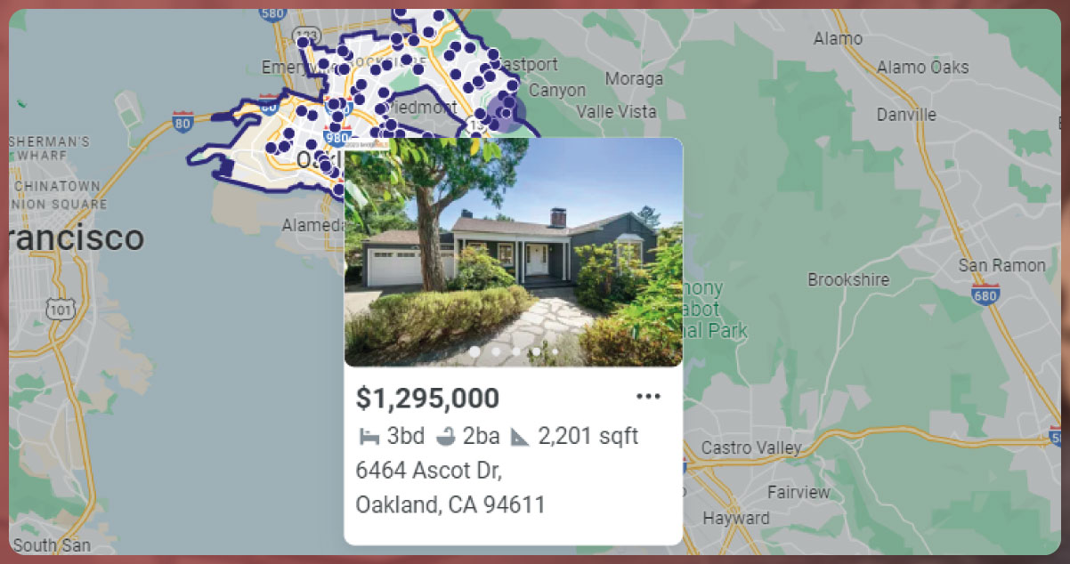
Generating Live Map Data
To generate live map data, you will combine the scraped real estate data with existing Geographic Information System (GIS) data and user-inputted information. Here's how to proceed:
Existing GIS Data:
- Access existing GIS data sources, such as shapefiles or map layers, to create a geographical framework.
- This GIS data should include geographic boundaries, property boundaries, roads, and other relevant spatial information.
Overlaying Data:
- Overlay the scraped real estate data onto the GIS map layers. This process involves matching property locations with corresponding map coordinates.
- Visualize the data on the map, allowing users to interact with and explore the real estate information spatially.
Integration with Other Modules:
- Ensure that this live map data serves as a central visualization platform for other modules, such as cellular tower suitability, adjacent parcel analysis, and more.
- Users can use the map to make informed decisions based on the combined information.
Module 1: Cell Towers Data Retrieval
Obtaining Data from Antenna and Cellular Tower Databases
1. Antenna and Tower Databases: Seek out databases or sources that provide information about cellular antennas and towers. This data may include details about tower locations, heights, owners, and technologies used.
2. Integration with Databases: Develop a data retrieval mechanism to integrate with these databases or sources. Depending on the availability and accessibility of data, you might need to use APIs, scrape websites, or acquire datasets from government agencies or industry sources.
3. Data Enrichment: Once you retrieve data, you may need to enrich it with additional information such as tower signal coverage areas, technologies deployed (3G, 4G, 5G), and tower ownership details. This comprehensive dataset will be crucial for your analysis.
Data Analysis
Combining Data for Tower Suitability Assessment
After obtaining data about antenna and cellular tower locations, you'll need to perform a comprehensive analysis to determine the suitability of a land parcel for hosting cellular towers. Here's how to approach this analysis:
1. Radio Signal Strength Data
- Obtain or access radio signal strength data for the region, which typically includes signal strength measurements for different frequency bands (e.g., 700 MHz, 2.4 GHz).
- Overlay this signal strength data with the geographic coordinates of existing towers and antennas.
- Analyze signal strength patterns to identify areas with weak or inadequate coverage. These areas may indicate potential locations for new towers.
2. Cellular Coverage Assessment
- Combine data about existing cellular coverage areas with information on tower locations.
- Assess the coverage gaps or areas with poor signal quality. These gaps may represent opportunities for tower placement to improve coverage.
3. Local Ordinances and Zoning Regulations
- Research and gather data on local zoning regulations and ordinances related to cellular towers within the jurisdiction where the land parcel is located.
- Analyze these regulations to determine if the selected land parcel complies with zoning requirements for tower placement.
4. Suitability Scoring
- Develop a scoring system that takes into account signal strength, coverage gaps, and compliance with local ordinances.
- Assign suitability scores to different areas within the land parcel.
- Identify areas with high suitability scores as potential tower installation sites.
5. Visualization
- Visualize the analysis results on maps, overlaying signal strength, coverage, and suitability scores.
- Use color coding or heatmap representations to make it easy for users to identify suitable areas.
6. Interactive User Interface
- Create an interactive user interface that allows users to explore the map and view detailed information about each potential tower site.
- Provide tools for users to filter and refine the results based on specific criteria or preferences.
Module 1 - Cell Towers involves retrieving data from antenna and cellular tower databases and conducting a thorough data analysis to determine the suitability of a land parcel for hosting cellular towers. The integration of signal strength data, coverage assessment, local ordinances, and visualization tools empowers users to make informed decisions about tower placement to enhance cellular coverage in specific areas. This module plays a critical role in the broader real estate investment decision-making process.
Module 2: Sale to Adjacent Parcel Owners Data Analysis
Analyzing Data from Adjacent Land Parcels
When considering the sale of a land parcel to adjacent owners, a thorough data analysis is crucial. This analysis involves evaluating data from adjacent land parcels to assess suitability and attractiveness for potential buyers. Here's how to approach this analysis:
1. Data Acquisition
- Begin by collecting data on adjacent land parcels surrounding the target parcel. This data can include property details, ownership information, assessed values, and historical sales data.
- Ensure that you have access to comprehensive and up-to-date records for all neighboring parcels.
2. Property Characteristics
- Examine the characteristics of the target parcel in comparison to adjacent parcels. Consider factors such as size, shape, topography, and zoning classifications.
- Identify any unique features or advantages that the target parcel may offer compared to neighboring properties.
3. Ownership Analysis
- Analyze ownership details of both the target parcel and adjacent parcels. Determine whether the same owner holds multiple adjacent properties.
- Explore the ownership history to identify any changes or trends in ownership patterns.
4. Comparative Market Analysis (CMA)
- Conduct a Comparative Market Analysis (CMA) to assess property values in the area. This involves comparing recent sales prices of similar properties in the vicinity.
- Determine whether the target parcel's asking price aligns with market trends.
5. Market Demand
- Research the local real estate market to gauge demand for properties similar to the target parcel.
- Consider factors such as population growth, economic development, and infrastructure projects that may influence demand.
6. Feasibility Assessment
- Assess the feasibility of merging the target parcel with adjacent properties. Consider legal and zoning requirements that may impact the consolidation of parcels.
- Determine if there are any restrictions, easements, or encumbrances on the target parcel that could affect its suitability for sale.
7. Negotiation Strategy
- Develop a negotiation strategy based on the analysis results. Determine the appropriate asking price for the target parcel and the terms of the sale.
- Consider whether offering incentives, such as favorable financing terms or additional land, could make the sale more attractive to adjacent owners.
8. Communication
- Establish communication channels with adjacent property owners to gauge their interest in acquiring the target parcel.
- Provide clear and compelling information about the benefits of acquiring the parcel, emphasizing any advantages it offers.
9. Legal and Financial Considerations
- Consult legal and financial experts to ensure that the sale transaction complies with all applicable laws and regulations.
- Address tax implications, transfer of ownership, and any other legal aspects of the sale.
10. Documentation and Contracts
- Prepare all necessary documentation, including contracts, deeds, and agreements, to formalize the sale.
- Ensure that all parties involved fully understand and agree to the terms of the transaction.
Module 2 involves a comprehensive analysis of data from adjacent land parcels to evaluate the suitability of selling the target parcel to adjacent owners. This analysis considers property characteristics, market conditions, ownership patterns, legal requirements, and negotiation strategies. By conducting a thorough assessment, you can make informed decisions about the sale that benefit both parties involved.
Module 3: Farm Equipment Storage Data Analysis
Combining Data with Local Road Information
In Module 3, the objective is to assess the suitability of a land parcel for farm equipment storage by combining the collected real estate data with local road information. This analysis helps determine whether the parcel is easily accessible and conducive to storing various types of farm equipment, including vehicles, trailers, RVs, and mobile homes. Here's a step-by-step breakdown of the data analysis process:
1. Data Collection
- Gather comprehensive data about the land parcel, including its dimensions, shape, legal type, legal description, assessed value, and property taxes. This data forms the foundation for the analysis.
- Collect information about the local road network, including road types (e.g., paved, gravel), road widths, access points, and proximity to highways or main transportation routes.
2. Property Dimensions and Layout
- Examine the dimensions and shape of the land parcel to determine if it can accommodate the storage needs of various farm equipment.
- Consider the layout of the parcel, including open spaces, clearances, and potential obstacles.
3. Accessibility and Road Conditions
- Assess the accessibility of the land parcel from the nearest roads. Evaluate whether there are existing driveways or entrances.
- Analyze the conditions of local roads, including their suitability for transporting farm equipment. Paved roads are generally preferred for ease of access.
4. Distance to Key Facilities
- Calculate the distance from the land parcel to essential facilities such as agricultural supply stores, repair shops, and markets.
- Determine whether the location offers convenient access to necessary services for farm equipment maintenance.
5. Zoning and Regulations
- Research local zoning regulations and land use ordinances to ensure that farm equipment storage is permitted on the land parcel.
- Verify if there are any restrictions or requirements related to farm equipment storage, such as setbacks or screening requirements.
6. Safety and Security
- Consider safety and security factors. Analyze the parcel's proximity to emergency services, fire stations, and law enforcement agencies.
- Evaluate whether the location provides a secure environment for storing valuable farm equipment.
7. Suitability Scoring
- Develop a suitability scoring system that takes into account factors like accessibility, road conditions, distance to facilities, and compliance with regulations.
- Assign suitability scores to different aspects of the land parcel, allowing for a quantitative assessment of its suitability for farm equipment storage.
8. Visualization and Reporting
- Visualize the analysis results on maps, indicating key features such as roads, entrances, and suitability zones.
- Create comprehensive reports that summarize the findings and provide recommendations for farm equipment storage on the parcel.
9. User Interaction
- Design an interactive interface that allows users to explore the analysis results and customize parameters to meet their specific needs.
- Provide tools for users to simulate different scenarios, such as rearranging equipment or expanding storage areas.
Module 3 - Farm Equipment Storage involves a detailed data analysis process that combines real estate data with local road information to assess the suitability of a land parcel for storing farm equipment. By evaluating accessibility, road conditions, proximity to facilities, zoning regulations, safety, and security, you can make informed decisions about the parcel's viability for this purpose. This module is essential for farmers and agricultural businesses seeking efficient and secure storage solutions for their equipment.
Module 4: Billboards or Signage Data Analysis Combining Data with Local Traffic Data

In Module 4, the goal is to determine the suitability of a land parcel for billboards or signage by combining the collected real estate data with local traffic data. This analysis helps assess the visibility and potential advertising value of the parcel. Here's a comprehensive breakdown of the data analysis process:
1. Data Collection
- Gather detailed data about the land parcel, including its location, dimensions, shape, legal type, legal description, assessed value, and property taxes. This forms the foundational real estate data for analysis.
- Collect local traffic data, which includes information about traffic volume, traffic patterns, and the demographic profile of commuters in the area. This data may be available from local transportation departments or traffic monitoring agencies.
2. Parcel Location and Visibility
- Analyze the location of the land parcel in relation to major roadways, highways, and intersections. Determine its visibility from high-traffic areas.
- Assess whether the parcel is situated near traffic signals, stop signs, or congestion points, where drivers may have extended viewing time.
3. Traffic Volume and Patterns
- Utilize the local traffic data to understand the volume and flow of traffic near the parcel. Identify peak traffic hours and commuter patterns.
- Consider factors such as the average daily traffic (ADT) count, which measures the number of vehicles passing by the location daily.
4. Demographic Analysis
- Examine the demographic profile of the commuters and passersby in the area. Understand the target audience for potential advertising campaigns.
- Consider factors such as age groups, income levels, and interests to tailor signage or billboard content effectively.
5. Zoning and Regulations
- Research local zoning regulations and sign ordinances to ensure compliance with restrictions on billboard or signage placement.
- Verify if there are any restrictions related to sign size, height, lighting, and content.
6. Suitability Scoring
- Develop a suitability scoring system that combines factors such as visibility, traffic volume, demographic alignment, and regulatory compliance.
- Assign suitability scores to different aspects of the land parcel, allowing for a quantitative assessment of its suitability for billboards or signage.
7. Visualization and Mockups
- Create visual mockups or simulations of potential billboard or signage placements on the land parcel. Use geographic data and traffic patterns to inform these mockups.
- Visualize how the proposed signage would appear to drivers and pedestrians from various angles and distances.
8. Return on Investment (ROI) Analysis
- Calculate the potential ROI for billboard or signage advertising on the land parcel. Estimate revenue generated from advertising contracts.
- Consider factors such as ad rates, contract durations, and maintenance costs.
9. User Interaction
- Design an interactive interface that allows users to explore the analysis results, visualize sign placements, and simulate advertising scenarios.
- Provide tools for users to adjust variables like sign size, content, and pricing to assess different scenarios.
Module 4 - Billboards or Signage involves a data analysis process that combines real estate data with local traffic data to determine the suitability of a land parcel for billboard or signage placement. By assessing visibility, traffic volume, demographics, zoning regulations, and potential ROI, you can make informed decisions about whether the parcel offers an attractive opportunity for outdoor advertising. This module is essential for businesses and advertisers seeking strategic locations for their promotional efforts.
Module 5: Wind Turbine or Solar Panel Installation
Data Analysis
Combining Data for Renewable Energy Suitability Assessment
In Module 5, the objective is to assess the suitability of a land parcel for renewable energy installations, specifically wind turbines or solar panels. This analysis combines the collected real estate data with information related to sun exposure, wind strength, existing wind turbines, and local ordinances. Here's a step-by-step breakdown of the data analysis process:
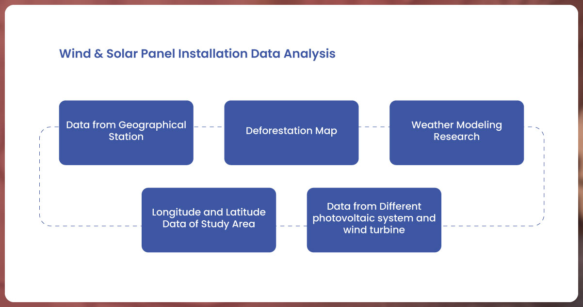
1. Data Collection
- Gather comprehensive data about the land parcel, including its location, dimensions, shape, legal type, legal description, assessed value, property taxes, and any existing structures.
- Collect data related to sun exposure, including solar irradiance levels, daily sunlight hours, and seasonal variations. This data may be available from weather agencies or solar energy databases.
- Acquire wind strength data, which includes historical wind speed and direction information. Local weather stations or wind energy databases are potential sources.
- Identify the presence of existing wind turbines in the vicinity of the land parcel and gather data about their locations, capacities, and ownership.
2. Sun Exposure Analysis
- Analyze sun exposure data to determine the parcel's solar potential. Consider factors such as annual solar radiation, shading from nearby structures or trees, and the availability of unobstructed sunlight.
- Estimate the energy generation capacity of solar panels on the land parcel, taking into account the orientation and tilt of solar arrays.
3. Wind Strength Assessment
- Evaluate wind strength data to assess the suitability for wind turbine installations. Identify average wind speeds, wind direction patterns, and seasonal variations.
- Calculate the wind energy potential of the land parcel, considering the height of potential turbine installations and wind turbine capacity factors.
4. Existing Wind Turbines
- Study the presence of nearby wind turbines and their impact on the local wind environment. Assess whether existing turbines create turbulence or interference that could affect new installations.
- Determine if there are opportunities for collaboration or synergy with existing wind energy projects.
5. Local Ordinances and Zoning Regulations
- Research local ordinances and zoning regulations related to renewable energy installations. Verify whether the land parcel complies with zoning requirements for wind turbines or solar panels.
- Check for any permit requirements, setback restrictions, noise limits, or height limitations.
6. Suitability Scoring
- Develop a suitability scoring system that combines factors such as sun exposure, wind strength, local ordinances, and potential energy generation capacity.
- Assign suitability scores to different areas within the land parcel, allowing for a quantitative assessment of its suitability for renewable energy installations.
7. Visualization and Simulation
- Create visual simulations or models that illustrate how solar panels or wind turbines could be deployed on the land parcel.
- Use geographic data, sun exposure, and wind strength to visualize the placement and orientation of renewable energy infrastructure.
8. Financial Projections
- Calculate financial projections for renewable energy projects on the land parcel. Estimate the potential revenue, savings, and payback period for solar panels or wind turbines.
- Consider factors such as electricity rates, incentives, tax credits, and maintenance costs.
9. User Interaction
- Design an interactive interface that allows users to explore the analysis results, adjust parameters, and visualize the potential impact of renewable energy installations.
- Provide tools for users to assess different scenarios, including variations in turbine heights, panel configurations, and energy generation estimates.
Module 5 - Wind Turbine or Solar Panel Installation involves a comprehensive data analysis process that combines real estate data with sun exposure, wind strength, existing infrastructure, and regulatory considerations to assess the suitability of a land parcel for renewable energy projects. By evaluating solar potential, wind energy potential, local regulations, and financial viability, you can make informed decisions about harnessing renewable energy resources on the parcel. This module is essential for individuals and organizations seeking to contribute to sustainability and energy independence through renewable energy installations.
Module 6: Alternative Uses Data Analysis
Evaluating Alternative Uses for Similar Parcels
Module 6 is dedicated to evaluating alternative uses for land parcels based on the data collected from various sources. The objective is to identify creative and profitable ways to utilize similar parcels beyond their primary intended purposes. Here's a comprehensive breakdown of the data analysis process:
1. Data Collection
- Gather comprehensive data about the land parcels under consideration. This data includes location, dimensions, shape, legal type, legal description, assessed value, property taxes, zoning classifications, and any other relevant attributes.
- Ensure that you have consistent and up-to-date data for all parcels in the analysis.
2. Parcel Comparison
- Begin by selecting a group of similar parcels that share common characteristics. These characteristics may include size, shape, zoning, location, proximity to amenities, and historical use.
- Grouping parcels with similar attributes allows for meaningful comparisons.
3. Market Research
- Conduct market research to understand current trends and demands in the local real estate market. Identify emerging opportunities and areas of growth.
- Analyze economic, demographic, and market dynamics that may influence alternative land uses.
4. Feasibility Assessment
- Evaluate the feasibility of alternative land uses for the selected parcels. Consider the physical attributes of the land, such as topography, soil quality, and infrastructure access.
- Assess whether the proposed alternative uses align with existing zoning regulations and land use plans.
5. Financial Projections
- Calculate financial projections for each alternative use scenario. Estimate potential revenues, expenses, and return on investment (ROI) for each option.
- Consider factors such as construction costs, operational expenses, market demand, and potential rental or sale income.
6. Environmental Impact
- Assess the environmental impact of alternative land uses. Consider factors such as sustainability, conservation, and potential ecological benefits or challenges.
- Ensure compliance with environmental regulations and seek opportunities for eco-friendly development.
7. Regulatory Compliance:
- Review local zoning ordinances, land use regulations, and permitting requirements for each proposed alternative use.
- Identify any legal obstacles or hurdles that may need to be addressed, such as rezoning requests or special permits.
8. Suitability Scoring
- Develop a suitability scoring system that considers factors like financial viability, market demand, environmental impact, and regulatory compliance.
- Assign suitability scores to each parcel and alternative use scenario to facilitate comparison.
9. Visualization and Presentation
- Create visual presentations and reports that highlight the potential alternative uses for each parcel. Use maps, diagrams, and renderings to illustrate concepts.
- Clearly articulate the benefits and challenges of each alternative use.
10. Stakeholder Engagement
- Engage with stakeholders, including property owners, developers, investors, and local authorities, to discuss and refine alternative use proposals.
- Seek input and collaboration to maximize the potential of each parcel.
11. Decision-Making Support
- Provide decision-makers with comprehensive analysis reports, including suitability scores, financial projections, and environmental impact assessments.
- Facilitate informed decisions regarding the selection of alternative land uses.
12. Implementation Planning
- Develop implementation plans for the selected alternative uses, outlining the steps required for development or redevelopment.
- Address project timelines, budgets, and resource allocation.
Module 6 - Alternative Uses involves a thorough data analysis process that explores creative and profitable ways to utilize land parcels beyond their primary intended purposes. By considering market trends, feasibility, financial projections, environmental impact, and regulatory compliance, you can identify opportunities for innovative and sustainable land use. This module is essential for optimizing the potential of land assets and contributing to community development and economic growth.
What is the role of Actowiz Solutions in taking Real estate investment decisions greatly from data-driven analysis?

Actowiz Solutions plays a significant role in facilitating data-driven real estate investment decisions by providing comprehensive data analytics and solutions tailored to the real estate industry. Here's an overview of the role Actowiz Solutions plays in this context:
Data Aggregation and Integration: Actowiz Solutions specializes in collecting and aggregating diverse data sources relevant to the real estate market. This includes property details, market trends, financial data, geographic information, zoning regulations, and more. By centralizing and integrating this data, Actowiz ensures that investors have access to a holistic view of the real estate landscape.
Data Quality and Accuracy: Ensuring data accuracy is paramount in real estate investments. Actowiz employs data validation and cleaning processes to maintain the quality and integrity of the data. Reliable data is crucial for making informed investment decisions.
Advanced Analytics: Actowiz Solutions leverages advanced analytics and machine learning techniques to extract valuable insights from the data. This includes predictive modeling, market forecasting, risk assessment, and trend analysis. These analytics help investors identify profitable opportunities and potential risks.
Customized Dashboards and Reports: Actowiz provides customized dashboards and reports that present complex data in a clear and user-friendly manner. Investors can visualize key performance indicators, market trends, and investment options, enabling them to make well-informed decisions.
Market Research: Actowiz conducts in-depth market research to identify emerging trends, growth areas, and investment hotspots. This research helps investors align their strategies with market dynamics and maximize returns.
Risk Assessment: Actowiz Solutions assists investors in evaluating risk factors associated with real estate investments. This includes assessing factors such as market volatility, economic conditions, regulatory changes, and property-specific risks. Investors can make risk-adjusted decisions with greater confidence.
Compliance and Regulations: Real estate investments are subject to various legal and regulatory requirements. Actowiz Solutions keeps investors informed about compliance obligations, zoning regulations, tax implications, and legal considerations, ensuring that investments align with local laws.
Scenario Modeling: Actowiz enables investors to conduct scenario modeling, allowing them to explore different investment scenarios and assess their potential outcomes. This helps investors make strategic decisions that align with their financial goals.
Cost-Benefit Analysis: The company assists investors in conducting cost-benefit analyses for real estate projects. This includes evaluating construction costs, financing options, operational expenses, and expected returns.
Client Support and Training: Actowiz Solutions offers ongoing client support and training to ensure that investors can effectively utilize their data-driven tools and resources. This support enhances the decision-making process.
Innovation and Technology: Actowiz stays at the forefront of technological advancements in real estate analytics. This includes incorporating AI, machine learning, and data visualization techniques to provide cutting-edge solutions.
Conclusion
Actowiz Solutions plays a pivotal role in empowering real estate investors to make data-driven investment decisions. By offering data aggregation, analytics, market research, risk assessment, and compliance support, Actowiz equips investors with the insights and tools needed to optimize their real estate portfolios and achieve their investment objectives. This data-driven approach enhances the efficiency and effectiveness of real estate investment decisions. For more details, contact Actowiz Solutions now! You can also reach us for all your data collection, mobile app scraping, instant data scraper and web scraping service requirements.
 Core Scraping Services
Amazon Data Scraping #1 Walmart Data Scraping Shopify Store Scraping HOT TikTok Shop Scraping HOT Flipkart Data Scraping
Core Scraping Services
Amazon Data Scraping #1 Walmart Data Scraping Shopify Store Scraping HOT TikTok Shop Scraping HOT Flipkart Data Scraping Top Global Platforms
 Platforms by Region
🇺🇸 USA🇬🇧🇪🇺 UK/EU🇮🇳 India🇦🇪 ME🌏 SEA🌎 LATAM🇨🇳🇯🇵🇰🇷🇦🇺 AUAmazon Data Scraping #1 Walmart Data Scraping Target Data Scraping NEW Shopify Scraping HOT TikTok Shop Scraping HOT Costco Data Scraping NEW Best Buy Scraping NEW Home Depot Scraping NEW Etsy Data Scraping NEW Shein Data Scraping NEW DoorDash Scraping NEW Instacart Scraping NEWTesco Data Scraping NEW Sainsbury's Scraping NEW ASDA Data Scraping NEW Ocado Scraping NEW ASOS Data Scraping NEW Rightmove Scraping NEW Deliveroo Scraping NEW Zalando Scraping NEW Otto Scraping NEW Cdiscount Scraping NEW Carrefour Scraping NEW Allegro Scraping NEW Bol.com Scraping NEWFlipkart Data Scraping JioMart Data Scraping NEW BigBasket Scraping NEW Myntra Data Scraping NEW Nykaa Data Scraping NEW Blinkit Data Scraping Zepto Data Scraping Zomato Data Scraping Swiggy Data ScrapingNoon Data Scraping NEW Amazon.ae Scraping NEW Talabat Data Scraping NEW Careem Data Scraping NEW PropertyFinder Scraping NEW
Platforms by Region
🇺🇸 USA🇬🇧🇪🇺 UK/EU🇮🇳 India🇦🇪 ME🌏 SEA🌎 LATAM🇨🇳🇯🇵🇰🇷🇦🇺 AUAmazon Data Scraping #1 Walmart Data Scraping Target Data Scraping NEW Shopify Scraping HOT TikTok Shop Scraping HOT Costco Data Scraping NEW Best Buy Scraping NEW Home Depot Scraping NEW Etsy Data Scraping NEW Shein Data Scraping NEW DoorDash Scraping NEW Instacart Scraping NEWTesco Data Scraping NEW Sainsbury's Scraping NEW ASDA Data Scraping NEW Ocado Scraping NEW ASOS Data Scraping NEW Rightmove Scraping NEW Deliveroo Scraping NEW Zalando Scraping NEW Otto Scraping NEW Cdiscount Scraping NEW Carrefour Scraping NEW Allegro Scraping NEW Bol.com Scraping NEWFlipkart Data Scraping JioMart Data Scraping NEW BigBasket Scraping NEW Myntra Data Scraping NEW Nykaa Data Scraping NEW Blinkit Data Scraping Zepto Data Scraping Zomato Data Scraping Swiggy Data ScrapingNoon Data Scraping NEW Amazon.ae Scraping NEW Talabat Data Scraping NEW Careem Data Scraping NEW PropertyFinder Scraping NEW Pricing & Promotions
MAP Violations Brand Protection Counterfeit Detection Price Intelligence AI HOT Data Intelligence
Pricing & Promotions
MAP Violations Brand Protection Counterfeit Detection Price Intelligence AI HOT Data Intelligence Brand & Intelligence
Share of Search Content Audit & PDP Reviews & Ratings Retail Media Buy Box Monitoring Social Commerce HOT Live Commerce NEW Agentic Commerce NEW
Brand & Intelligence
Share of Search Content Audit & PDP Reviews & Ratings Retail Media Buy Box Monitoring Social Commerce HOT Live Commerce NEW Agentic Commerce NEW Digital Shelf & Search
Assortment Planning Competitive Benchmarking Product Availability Seller Intelligence NEW Q-Commerce NEW
Digital Shelf & Search
Assortment Planning Competitive Benchmarking Product Availability Seller Intelligence NEW Q-Commerce NEW AssortmentE-commerce Intelligence Hyperlocal Insights POI & Store Locator DTC Brand Analytics NEW
 For Retailers
 E-Commerce Dashboard
 Flipkart Insights (Live) #1
 Grocery Intelligence
.svg) Grocery Price (U.S.)
Grocery Price (U.S.)
.svg) Quick Commerce (India) HOT
Quick Commerce (India) HOT
 Food & Restaurant
 Fashion Intelligence
 Automotive
 Travel & Hospitality
 Real Estate
 Food Delivery Intelligence NEW
 OTT & Streaming NEW
 By Use Case
 Pricing Intelligence
 Digital Shelf Analytics
 MAP Monitoring HOT
 Cross-Border Price Parity NEW
 Share of Search
 Review Sentiment
 Kitchen Market Gaps NEW
 Dynamic Pricing / AI Repricing NEW
 Promotions & Deals Alerts NEW
 B2B / POI & Lead Data NEW
 By Region🇮🇳 India 🇺🇸 USA 🇦🇪 Middle East 🇬🇧 UK 🇦🇺 Australia 🌏 SE Asia 🇪🇺 Europe 🌎 LATAMIndia
 Flipkart Real-Time Insights
 Quick Commerce — Zepto · Blinkit
 Pincode Price Tracker
USA
Pincode Price Tracker
USA Grocery Price Tracker (U.S.)
 GCC Q-Commerce — Talabat · Noon NEW
UK
GCC Q-Commerce — Talabat · Noon NEW
UK Grocery Price — Tesco · Sainsbury's · Asda NEW
Australia
Grocery Price — Tesco · Sainsbury's · Asda NEW
Australia Grocery Price — Coles · Woolworths NEW
Want THIS view for your brand · your city · your category? Custom dashboard in 7 days. Free Consultation →
Grocery Price — Coles · Woolworths NEW
Want THIS view for your brand · your city · your category? Custom dashboard in 7 days. Free Consultation → Marketplace Scrapers
Amazon API TikTok Shop API HOT Uber Eats API Airbnb API Zepto / Blinkit API Instacart API NEW Talabat API NEW
Marketplace Scrapers
Amazon API TikTok Shop API HOT Uber Eats API Airbnb API Zepto / Blinkit API Instacart API NEW Talabat API NEW Data APIsWeb Extract API Reviews API SERP API Pricing Webhook NEW
 Universal APIsLive Crawler API Scheduler Realtime Alerts Webhook Delivery 🐍 Python SDK 💚 Node.js SDK
 Delivery & SDKs
 Knowledge Center
Digital Shelf Playbook MAP Compliance Guide Pricing Intel Guide Scraping Compliance TikTok Shop Guide NEW Cross-Border Guide NEW
Knowledge Center
Digital Shelf Playbook MAP Compliance Guide Pricing Intel Guide Scraping Compliance TikTok Shop Guide NEW Cross-Border Guide NEW Guides & Playbooks
Sample Datasets HOT ROI Calculator NEW API Postman Collection Demo Dashboards Free API Playground NEW Press Kit
Guides & Playbooks
Sample Datasets HOT ROI Calculator NEW API Postman Collection Demo Dashboards Free API Playground NEW Press Kit Downloads & Tools
Trust Center About Us FAQs Careers
Downloads & Tools
Trust Center About Us FAQs Careers Trust & Company
 Grocery & FMCG
 Finance & Legal
 Healthcare & Pharma
 Media & Entertainment
 Emerging Industries